Building heights of the Netherlands
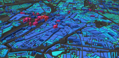
This interactive map shows the height of all the buildings in the Netherlands.
The information comes from the product 3D gebouwhoogte NL from the Kadaster.
The challenge was to convert a 3.3 GB dataset with 2.992.613 into an interactive 3D viewer. I transformed the GML to Mapbox Vector Tiles (MVT) with Tippecanoe. The application is made with HTML, CSS and JavaScript. Using Node and browserify to manage the packages. With the MapboxGL.js library the map was made and styled. Using Typeahead and Bloodhound for the search bar. The location suggest and lookup is based on the PDOK locatieserver API.
Later on I added a scroll story, which shows some information about the highest buildings in the Netherlands. Here we show some information about the geographic information this app is based on.
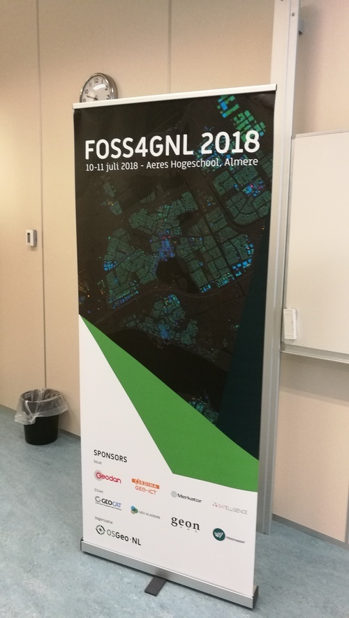
At Foss4G-NL 2018 my map was used as the background for their promotion materials! Matthew Petroff build a tool print maps to export MapboxGL maps to hight resolution images for printing. I forked this tool to insert my own map on order to export a high resolution image to make the banner from.
Inspiration:
Made for webmapper: ![]()